Lanes and arcades
Laneways are a second street plan, not a scavenger hunt
Melbourne’s centre is famous for lanes because the Hoddle Grid left room for service alleys that became public rooms. Walk them as streets. Do not treat them as a copied civic tour.
Melbourne’s laneways are not a branding exercise that happened in a single decade. They are the service grain of a nineteenth-century grid: lanes for carts, light and later, for bars, studios and painted walls. Visitors meet them as a surprise because the main streets are so wide. The surprise is geographic, not magical.
This hub names public alignments you can find on an ordinary map. It does not republish City of Melbourne’s walk copy, and it does not invent a bar list.
Two families of lane
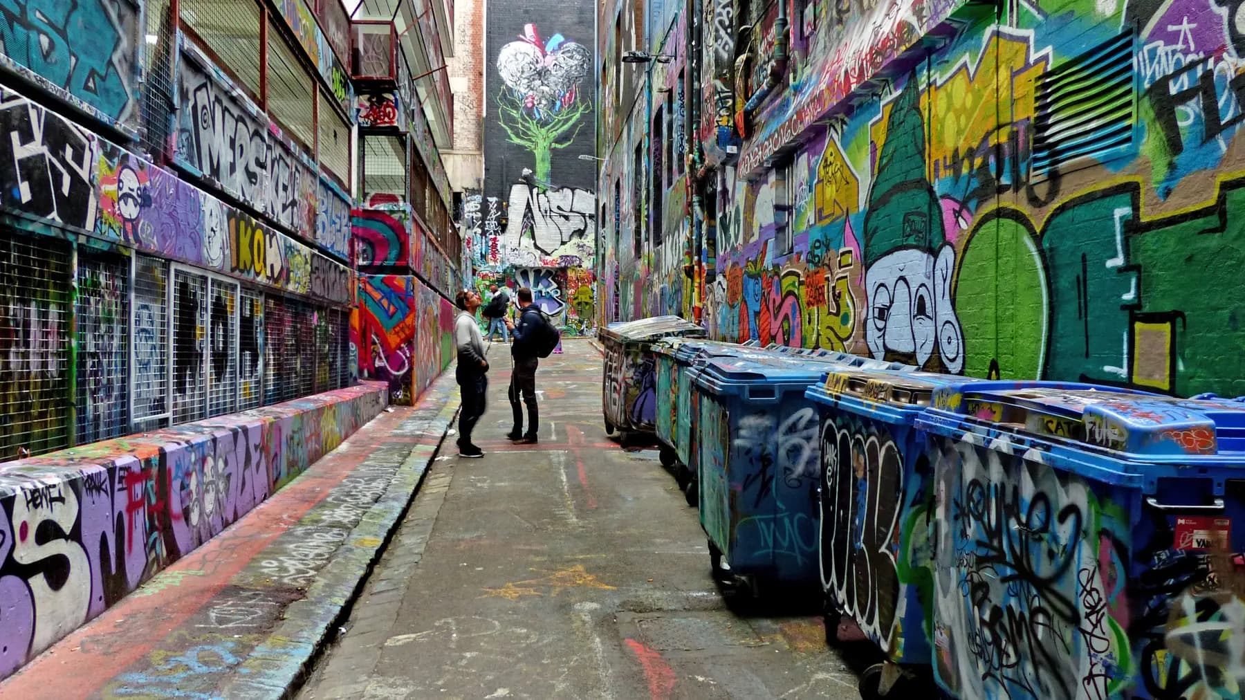
Open-air lanes — Hosier Lane, ACDC Lane, Centre Place, Degraves Street, Hardware Lane, parts of Flinders Lane — are streets. They have deliveries, residents, workers and weather. Street art, where it exists, is other people’s work and it changes. Read Hosier Lane before you assume a spray-can culture is an open invitation.
Covered arcades — Royal Arcade (opened 1870) and the Block Arcade (early 1890s) — are heritage retail interiors. They are closer to a civic living room than to a graffiti corridor. Tenants change. Building dates do not.
Treating both families as one “laneway experience” is how people walk through an arcade looking for murals and through Hosier Lane looking for marble.
A geography that actually helps
Start at Flinders Street Station. Degraves Street and the Centre Place / Centre Way cluster sit immediately north, connecting toward Flinders Lane and the retail streets beyond. This is the most common visitor entry because it is close, covered in parts, and dense. It is also easy to clog. Keep moving; do not picnic in a doorway.
Hosier Lane sits east of Federation Square’s visual field, running between Flinders Street and Flinders Lane. ACDC Lane is nearby and is named for the band; the naming is civic geography, not a concert. Both lanes are working city space.
Hardware Lane runs north–south in the north-west of the grid and is often described as a dining lane. That description is a type, not a reservation. Check premises yourself.
Flinders Lane is longer than a typical “lane” in the tourist sense: it is a street with buildings, loading and, in places, galleries. Walk a section. Do not try to “complete” it.
Rules that are not printed on a cute sign
- Street art is not communal stationery. If you did not get permission from the relevant owner or program, do not add paint.
- Drones, climbing and walking on canopies are not part of a laneway visit.
- Closed roller doors are closed. The city is allowed to have backs of house.
- Evening lanes can be loud and wet. They are not automatically unsafe, and they are not a theme-park after-dark ticket.
How this differs from a guided product
Guided laneway walks exist. Some are excellent. They are still commercial products with inclusions you must read on the operator’s page. This site will not name a favourite or invent a duration. If you want the self-guided version, use a map, this geography, and the laneway walk note.
City of Melbourne publishes its own walks and “what’s on” material. Those are civic pages. We link the idea of civic walks; we do not scrape their stop list.
Weather and crowds
Lanes concentrate people. A shower turns bluestone slick. A cruise-ship morning turns Centre Place into a queue. The fallback is always a covered arcade or a civic room — the library, a gallery, a station concourse — not a second identical lane two blocks away.
Little streets that are not quite lanes
Visitors collapse every narrow alignment into “a laneway”. Locals still say Little Collins, Little Bourke and Little Lonsdale as streets. They are the intermediate grain: narrower than Swanston, wider than Hosier, and full of ordinary businesses. Chinatown’s public face is Little Bourke. That matters because a tour that only sells “secret alleys” skips the street where the precinct actually lives.
Hardware Lane, Rankins Lane, Somerset Place and Manchester Lane appear on civic walking material for reasons of history (fabric trades, horse sales, studios). This guide names them as a class: northern and western lanes that repay a wander if you are already in that quarter. It does not turn them into a checklist you must complete to have “done Melbourne”.
How a lane relates to a station
Flinders Street Station feeds the southern lanes. Melbourne Central station and the State Library feed the northern civic block. Southern Cross feeds Docklands more than it feeds Degraves. Arriving at the wrong station for the lane you pictured is a common first-morning frustration. It is also solvable with a current map and, if you ride, the Free Tram Zone rule — not with a guessed shortcut through a car park.
What we will not map
We will not pin “the best hidden bar”. Hidden is a marketing adjective. If a door is public, you can find it. If a door is private, it is not content for this guide. We will not restore parked-era restaurant slugs as if they were still a dining directory.
Guides in this hub
The arcades are the CBD’s covered streets
Royal Arcade opened in 1870. The Block Arcade followed in the early 1890s. Together they are the easiest way to understand that Melbourne’s centre had indoor shopping streets before it had glass malls.
Hosier Lane is a street that happens to be painted
Hosier Lane runs between Flinders Street and Flinders Lane on the south-eastern side of the Hoddle Grid. People come for street art that changes. The lane remains a public thoroughfare with the same rules as any other city laneway.
At a glance
- Hosier LanePublic laneway known for changing street art
- Degraves / Centre PlacePedestrian lanes between Flinders and Flinders Lane
- Royal & BlockNineteenth-century shopping arcades off Collins Street
What people always ask
What is Hosier Lane?
Hosier Lane is a public CBD laneway between Flinders Street and Flinders Lane, known for frequently changing street art. It is not a ticketed gallery and painting is not automatically allowed.
Are the laneways an official walking tour?
No. City of Melbourne and other groups publish walks; this site does not copy those scripts. You can walk from Flinders Street through Degraves and the arcades without joining a tour.
Walk one cluster properly
Hosier Lane and the heritage arcades are different kinds of space. Read the guides before you flatten both into a single selfie route.
Hosier Lane guide